Monitoring at Sunrise Estates
Monitoring Goals
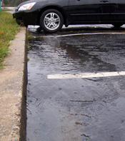
The amount of hard surfaces increase as neighborhoods develop. Rain that once soaked into fields and forests now runs off rooftops, parking lots, and road ways. Stormwater runoff from these surfaces flows into storm drains and untreated, into local rivers, lakes and streams. This runoff carries pollutants such as sediment, heavy metals, bacteria, nitrogen,a nd phosphorous that contaminates our waters and can put our health at risk. High volumes of runoff can erode stream banks, and cause localized flooding. Several local streams are impacted by urbanization and pollution. Nationally there has been a push to use green infrastructure to reduce pollution. Across the U.S., communities are using rain gardens, wetlands and bioretention features to capture, infiltrate and slow stormwater runoff.
In central Missouri, there is limited information on the effectiveness of various stormwater practices on reducing runoff. As part of Boone County's Hinkson Creek Urban Stormwater Retrofit Project, County personnel will monitor the effectiveness of some prevalent practices throughout Sunrise Estates until the spring of 2014.
This information will be shared with local developers and regulators to help make more informed decisions on how to best manage stormwater runoff.
Sunrise Estates Study Area
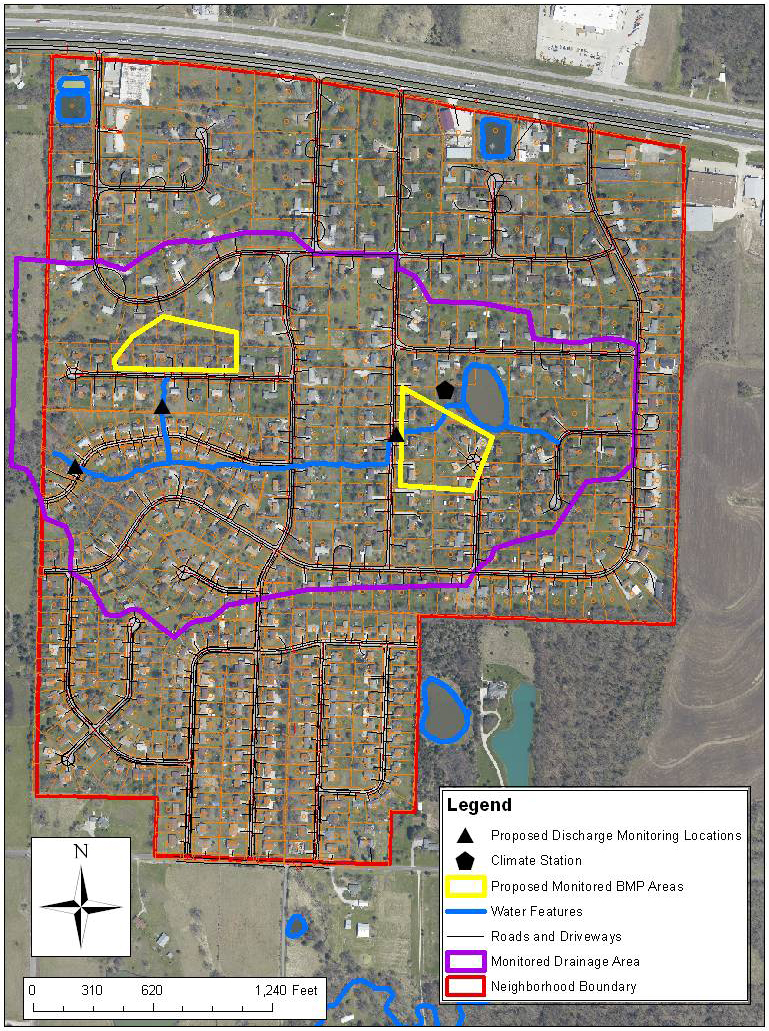
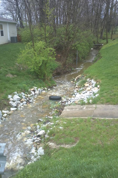
A large portion of Sunrise Estates, outlined in purple in the map to the left, drains through a box culvert identified by the triangle to the left on the map. This area can be thought of as a small drainage basin or catchment area. Our goal is to install several green infrastructure practices and measure the changes in the stream flow. This will help us understand how much runoff is reduced by individual practices, as well as their overall impact on the watershed.
Precipitation and Climate
In a catchment, the amount of water entering must equal the amount leaving over time (water balance). Water enters a catchment through precipitation and leaves either through surface runoff or evapotranspiration (a combination of evaporation and water use by plants, transpiration). To reduce surface runoff, more water needs to infiltrate into the ground and leave the catchment through evapotranspiration (for example, rain gardens where water is retained and used by plants).
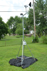
To learn about the effectiveness of practices such as rain gardens, first we need to know how much water is coming into the system. In August 2011, a climate station was installed in Sunrise Estates, near the neighborhood lake.
The station measures temperature, relative humidity, wind speed and direction, precipitation, and solar radiation. Measurements are recorded every five minutes, updated every 15 minutes, and is available through a web interface at on HOBOlink.com. Daily, weekly, and monthly graphs of climate data are available for viewing.
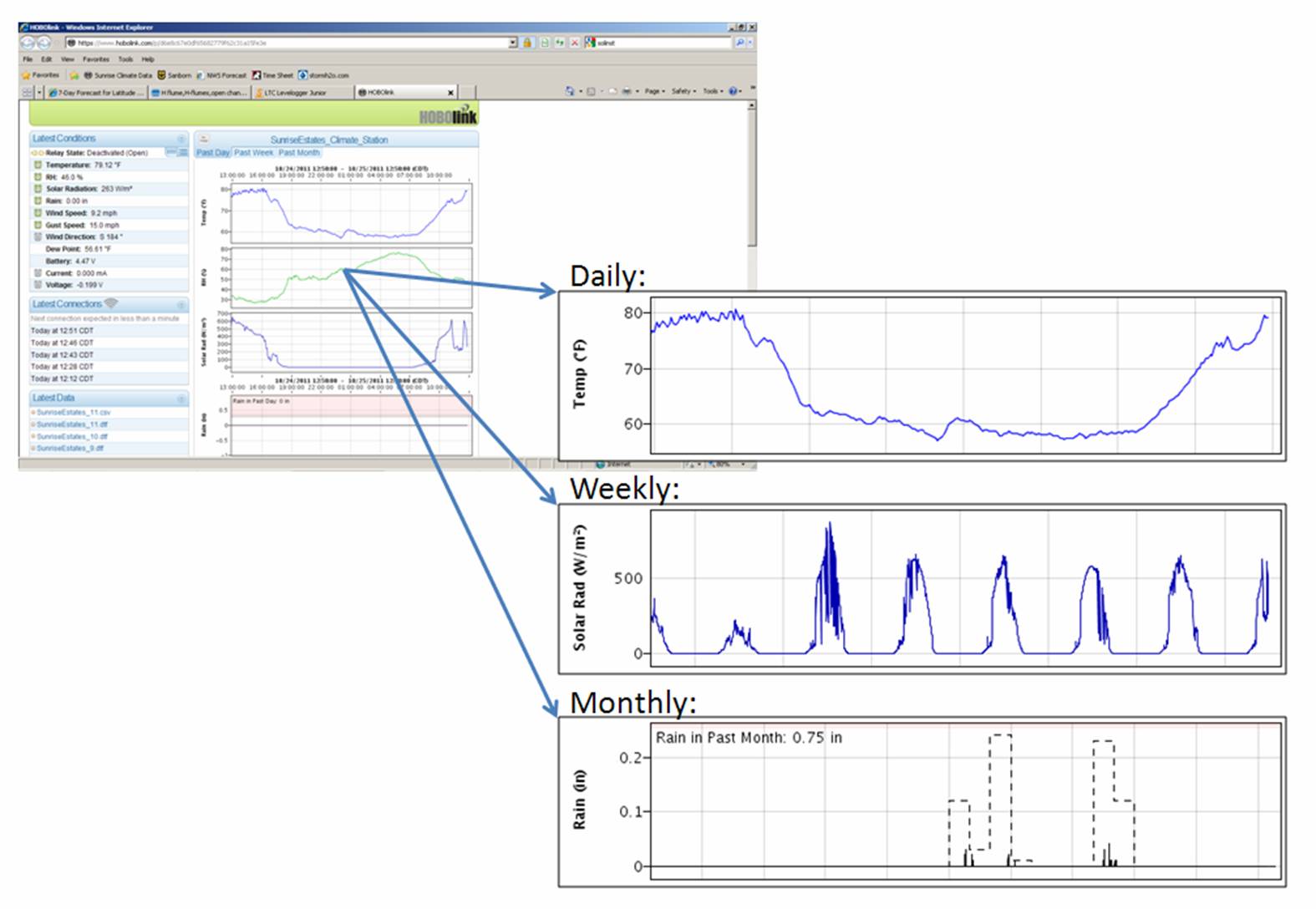
Climate data is important for a couple of reasons. It measures the amount of precipitation that falls in the drainage basin (i.e. how much water is entering the system), and estimates the amount of water leaving the basin through evapotranspiration, which depends on air temperature, relative humidity, wind speed, and solar radiation (sunlight).
The climate station is located near the Sunrise Estates lake. Various climate variables are collected and logged every five minutes.
Discharge
Boone County staff are in the process of measuring discharge (volume of water flowing past a point in a given unit of time, e.g. cubic feet per second) through the box culvert. This data will be used to characterize how the catchment responds to rain events of various size and intensity before and after BMPs are installed.
Measuring Catchment Discharge

To measure discharge, a water depth sensor has been installed just downstream of the box culvert at the study catchment outlet. Once a relationship between stage and discharge is developed, the depth sensor, which records data at five minute intervals, can be used to calculate discharge any time it records stage. Changes in runoff patterns will help demonstrate the effectiveness of BMPs.
Stage sensors, such as this submersible pressure transducer used at the catchment outlet, provide continuous measurements of water level.
Discharge at the Sunrise Estates catchment outlet (box culvert) following a rain event.
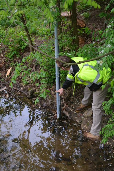
Ed Bulliner demonstrates the level water rises to during peak flow events.
Monitoring Rain Gardens
(Image: Chicago Field Museum)
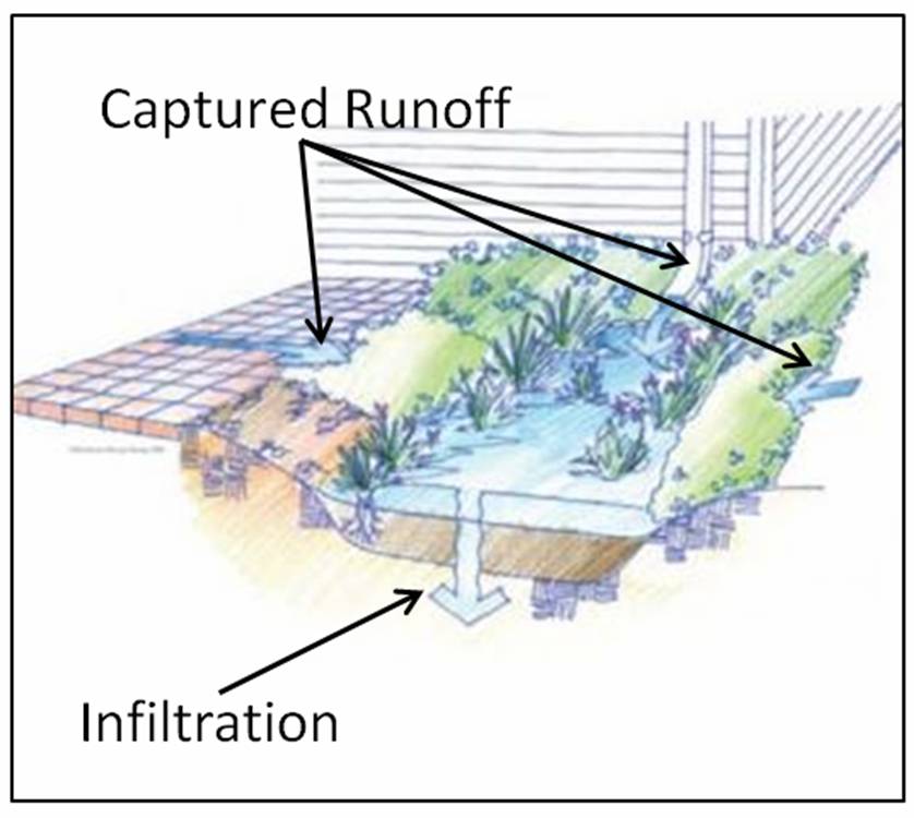
We will also be assessing the effectiveness of individual rain gardens in reducing stormwater runoff. In central Missouri, our clay soils have naturally low infiltration rates. As a result, altering the soil to allow for more infiltration is particularly important. Unfortunately, there is not much information for our region as to what alterations work best and which are the most cost effective. Therefore, we will be testing different soil mixes to determine which soil alteration results in the best infiltration rates and greatest decrease in stormwater runoff. These mixes will consist of different amounts of sand, compost, and topsoil.
Rain gardens reduce stormwater runoff by capturing water and infiltrating it into the ground. The primary goal of rain garden monitoring is to observe the amount of water infiltrated in the rain garden, and how quickly this infiltration occurs. Instruments will log how much water pools in the rain gardens, and how quickly the water level goes down. This data will allow us to calculate the volume of water infiltrated by the rain gardens.
Modeling Stormwater Runoff
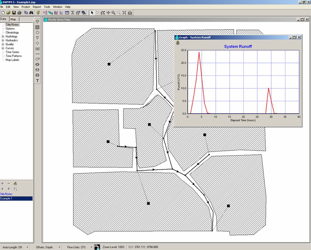
Sample output from EPA's Stormwater Management Model.
A model is a representation of a real world process. Models can range from very simple to very complex, and can be anything from a scale, physical replica, or complex computer program running numerous mathematical computations. There are many different kinds of models that can be used for managing stormwater. Modeling is planned using EPA's Stormwater Management Model (SWMM). More about the model can be found at https://www.epa.gov/nrmrl/wswrd/wq/models/swmm/.
The model uses information such as local soils, storm pipe location and dimensions, and measured precipitation data to calculate discharge at a downstream location. The model can incorporate BMPs installed within a watershed and predict discharge downstream for various sized rain events.
The model uses information such as local soils, storm pipe location and dimensions, and measured precipitation data to calculate discharge at a downstream location. The model can incorporate BMPs installed within a watershed and predict discharge downstream for various sized rain events.
Conclusion
Green Infrastructure practices have the potential to reduce stormwater runoff and improve the health of downstream aquatic ecosystems. However, before installing any sort of infrastructure, it is important to have a solid understanding of the benefits and any potential limitations. Understanding the effectiveness of green infrastructure practices requires monitoring not just the individual practices, but what impact they have on the surrounding area. Our monitoring at Sunrise Estates will begin to provide this information for our region.
US Environmental Protection Agency Region 7, through the Missouri Department of Natural Resources, has provided partial funding for this project under Section 319 of the Clean Water Act. G11-NPS-12