Boone County Internet Mapping Viewers

Developed by the Boone County GIS Department
Please note, in order to access the Boone County Internet Mapping Viewers you must have a valid login. Supported browsers and their minimum required version include Google Chrome 93.0, Firefox 93.0, Safari 14.0, or Edge 93.0. Also, in order for the print map tool to function correctly, you must turn off all pop-up blocking applications. The "Back" button at the top of web browsers will not function when using the map viewers. Please use the navigation buttons within the application to navigate.
Parcel Information Viewer
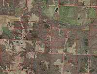
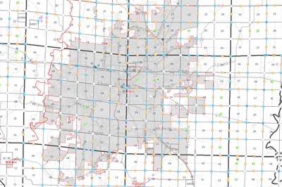
Maintained by the Boone County Assessor's Office, the Parcel Information Viewer enables you to view Boone County from the air and have the ability to locate property and zoom in for a closer look. Then, with few clicks of your mouse, you can display a property's owner information and tax history. The owner and tax information is coming directly from the Boone County Assessor's Tax System. The parcel linework is updated daily, the aerial photography used in this viewer was taken in spring 2019, 2017, 2015, 2011, 2007, and 2002, and the terrain view was developed using 2015 data.
Enter the Parcel Information Viewer
Aerial Photo Viewer
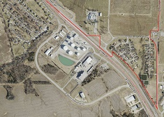
Maintained by the Boone County Assessor's Office, the Aerial Photo Viewer enables you to view Boone County from the air and have the ability to locate property and zoom in for a closer look. The aerial photography used in this viewer was taken in spring 2019, 2017, 2015, 2011, 2007, and 2002.
Plat Book
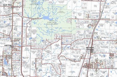
Maintained by the Boone County Assessor's Office, the Plat Book is available as a PDF to download and print or to view on your mobile device / PC using the map viewer. The Plat Book features township level ownership and reference maps, city area maps, County road map, park maps, reference maps, & road and owner index lists. The book is published each spring.
Downloadable Plat Maps
Download the full 2024 Plat Book or download a specific section of the Plat Book below:
Available historic Plat Books:
Hardcopy professionally printed and bound Plat Books are also available for purchase for $35 at the Boone County Assessor's Office, for more information please call (573) 886-4270.
Boone County Public Land Survey System (PLSS) Access System
Maintained by the Boone County Assessor's Office in coordination with the GIS Department and County Surveyor, the PLSS Access System enables you to view and retrieve information related to PLSS corners and National Geodetic Survey (NGS) benchmarks.