
Awards & Achievements
2017
Boone County GIS Appointed to National Geospatial Advisory Committee

On behalf of Boone County, Jason Warzinik has been appointed by the Secretary of the Interior to a second three-year term on the National Geospatial Advisory Committee. The Committee reports to the Chair of the Federal Geographic Data Committee and provides advice and recommendations related to management of Federal and national geospatial programs, the development of the National Spatial Data Infrastructure, and the implementation of Office of Management and GIS/mapping mandates. The Committee will review and comment upon geospatial policy and management issues and will provide a forum to convey views representative of non-federal stakeholders in the geospatial community.
2016
GIS Certification Institute

Matthew Smith, Boone County GIS Analyst II certified by the GIS Certification Institute as a GIS Professional (GISP).
Warzinik Wins Award for GIS Coordination

Jason Warzinik was nominated for this award based on many factors. In 2014/2015, he took a leadership role in the Fly MidMO Consortium for imagery and LiDAR acquisition. Because of Warzinik’s leadership, seven counties, including the City of Columbia and MU, were able to acquire imagery at a much reduced cost. He was able to obtain cost-sharing agreements with several entities such as utilities, USGS, State of Missouri & Department of Conservation. He also created compressed county-wide mosaics for all of the participating partners and for use in local emergency management.
2015
Multi-County Ortho Flight Completed
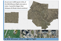
Seven counties were involved in a regional project that included 3,400 square miles of 3", 6" and 12" orthophotos and 700 square miles of 0.7m LiDAR. The project, coordinated by the Boone County GIS Department, included a number of cost-shares with local cities, utilities, MoMDOC, USGS, and the State of Missouri.
Internet Map Viewers Serve Out 36 Millionth Map

Boone County GIS Department provides access to the County GIS and map information through interactive mapping tools available online at the Boone County Assessor, Planning and Building, Clerk, Public Works, and Sheriff web sites. On March 3, 2008 over 36 million maps have been served since the release of the first viewer in February 2004.
Top 5 Digital Counties Survey

Boone County's web site was rated 4th in the nation for counties with less than 250,000 population in an annual study by the Center for Digital Government (Center) and National Association of Counties (NACo). Please see the July 16, 2015 Digital Counties press release for more information.
Boone County GIS Appointed to Missouri GIS Advisory Council

On behalf of Boone County, Jason Warzinik has been reappointed to an additional two-year term to serve on the Missouri GIS Advisory Council. The Council’s purpose is: to foster cooperation among state agencies, local governments, private industry, academia, federal government and others in the field of GIT; to advise and assist ITSD in the coordination and advancement of GIS in Missouri State Government; to develop and recommend GIS management procedures and goals for state government as outlined in the Missouri GIS Strategic Management Plan; to assure the highest quality of information and reduce unnecessary duplication in the application of GIS technology; to provide a forum for interaction among state government agencies and other stakeholders with regard to policies and standards on the development and uses of GIS; and to enhance the recognition of GIS at the local, state and federal levels through the sharing of GIS products and research findings.
2014
GIS Certification Institute
Heather Schafer, Boone County GIS Analyst certified by the GIS Certification Institute as a GIS Professional (GISP).
Achievement Award

A collaborative effort between the Boone County Public Works, Resource Management and Geographic Information System (GIS) departments has earned them a 2014 Achievement Award from the National Association of Counties. Please see the National Association of Counties 2014 press release for more information.
Excellence in Operations Management Award

A collaborative effort between the Boone County Public Works, Resource Management and Geographic Information System (GIS) departments has earned them the 2013 Excellence in Operations Management Award from Cartegraph, provider of Operations Management System technologies for the public sector. Boone County is one of only 10 municipal organizations to receive the award, which Cartegraph plans to grant annually as part of an initiative to promote and recognize the use of technology within municipal organizations to work smarter for the improvement of the community. Please see the Cartegraph 2013 press release for more information.
MidAmerica GIS Consortium Symposium Best Project Showcase Award

Heather Schafer Receives Best Project Showcase Award at the 2014 MidAmerica GIS Consortium Symposium - 2013 marked the first year that Boone County released their first in-house developed Plat Book. Created by the GIS Department for the Boone County Assessor's Office, the Plat Book is available as a traditional professionally printed and bound Plat Book as well as downloadable Adobe PDF files or viewable on a mobile device/PC using a map viewer. The Plat Book features township level ownership and reference maps, city area maps, County road map, park maps, reference maps, & road and owner index lists and is updated each spring.
Boone County GIS Appointed to National Geospatial Advisory Committee
On behalf of Boone County, Jason Warzinik has been appointed by the Secretary of the Interior to a three-year term on the National Geospatial Advisory Committee. The Committee reports to the Chair of the Federal Geographic Data Committee and provides advice and recommendations related to management of Federal and national geospatial programs, the development of the National Spatial Data Infrastructure, and the implementation of Office of Management and GIS/mapping mandates. The Committee will review and comment upon geospatial policy and management issues and will provide a forum to convey views representative of non-federal stakeholders in the geospatial community. Please see the Federal Geographic Data Committee press release for more information.
Boone County GIS and the Shared GIS Consortium Featured in ESRI Press Book

Boone County GIS and the Shared GIS Consortium was featured in ESRI's "The GIS Guide for Elected Officials". The case study focused on the 2-day visioning workshop put on in 2009 that brought together 27 representatives from within the local GIS community to obtain input on the future direction of the Share GIS Consortium.
2013
Outstanding Contribution to GIS award at 2013 Missouri GIS Conference
Warzinik wins Outstanding Contribution to GIS award at 2013 Missouri GIS Conference for his work in improving GIS services and capabilities at Boone County and the mid-Missouri area through his dedicated work with organizations such as the Shared GIS Consortium, MGISAC, and Region F E911 GIS Coordinators.
2011
Boone County GIS Appointed to Missouri GIS Advisory Council
On behalf of Boone County, Jason Warzinik has been appointed to a two-year term to serve on the Missouri GIS Advisory Council. The Council’s purpose is: to foster cooperation among state agencies, local governments, private industry, academia, federal government and others in the field of GIT; to advise and assist ITSD in the coordination and advancement of GIS in Missouri State Government; to develop and recommend GIS management procedures and goals for state government as outlined in the Missouri GIS Strategic Management Plan; to assure the highest quality of information and reduce unnecessary duplication in the application of GIS technology; to provide a forum for interaction among state government agencies and other stakeholders with regard to policies and standards on the development and uses of GIS; and to enhance the recognition of GIS at the local, state and federal levels through the sharing of GIS products and research findings.
ESRI to Highlight Boone County Apps in GIS Seminars
Boone County GIS will be featured regionally as part of ESRI's nationwide 'Extend the Reach of Your GIS' seminars.
ESRI ArcGIS 10.1 Beta Program
Boone County GIS selected to participate in the ArcGIS 10.1 beta program.
2010
ArcGIS Server JavaScript API Powered Applications Released
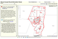
Boone County GIS Department released the Boone County Assessor Aerial and Parcel Information Viewers, both applications are powered by ArcGIS Server Advanced Edition JavaScript API.
2009
Digital Government Achievement Award (DGAA)

Boone County's Road Closures GIS application was selected as a winner in the Government-to-government category in an annual study by the Center for Digital Government. The Digital Government Achievement Awards showcase progressive and innovative Web sites and digital applications by government entities worldwide. The awards are judged by a panel of experts on a wide range of categories, including site accessibility, innovation, cost-savings, ease of use, and exceptional service to public. Please see the Digital Government 2009 press release for more information.
ESRI ArcGIS 9.4 Beta Program
Boone County GIS selected to participate in the ArcGIS 9.4 beta program.
2008
ArcGIS Server Powered Applications Released
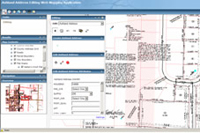
Boone County GIS Department released the Boone County Planning Information Viewer and the Ashland Address Editing Web Mapping Application, both applications are powered by ArcGIS Server Advanced Edition and are for internal staff.
Internet Map Viewers Serve Out 6 Millionth Map
Boone County GIS Department provides access to the County GIS and map information through interactive mapping tools available online at the Boone County Assessor, Planning and Building, Clerk, Public Works, and Sheriff web sites. On March 3, 2008 over 6,060,000 maps have been served since the release of the first viewer in February 2004.
ESRI ArcGIS 9.3 Beta Program
Boone County GIS selected to participate in the ArcGIS 9.3 beta program.
2007
GIS Certification Institute
Boone County GIS becomes the first entity in Missouri to have two Certified GIS Professionals (GISP) on staff.
Alternative ArcGIS Server Grant Award
Boone County GIS Department was selected as 1 of 283 to receive an alternative ArcGIS Server grant award. The grant was open to all disciplines preparing to develop GIS data, applications, and/or analytics to move their organizations forward via the next generation of server-based GIS. This award will provide the foundational tools required to upgrade Boone County’s Internet mapping with applications that will enable staff to view and edit GIS datasets in near real-time in the field or from remote locations.
ESRI ArcPad 7.1 Beta Program
Boone County GIS selected to participate in the ArcPad 7.1 beta program.
2006
ESRI International User Conference
Jason Warzinik, GIS Program Manager, showcased the Boone County’s ArcIMS Viewers at the 2006 ESRI User Software Applications Fair. Jonathan Bode, GIS Analyst, showcased two of his custom GIS maps at the 2006 ESRI Map Gallery.
Internet Map Viewers Serve Out 3 Millionth Map
Boone County GIS Department provides access to the County GIS and map information through interactive mapping tools available online at the Boone County Assessor, Planning and Building, Clerk, Public Works, and Sheriff web sites. On April 30, 2006 over 3,100,000 maps have been served since the release of the first viewer in February 2004.
2005
Top 10 Digital Counties Survey

Boone County's web site was rated 5th in the nation for counties with less than 150,000 population in an annual study by the Center for Digital Government (Center) and National Association of Counties (NACo).
International Association of Assessing Officers (IAAO) Mobile Data Collection Grant
Boone County was selected to receive a Mobile Data Collection Grant to assist in expanding our available technology as well as bridge the mapping functions between the office and field.
2004
ESRI Special Achievement in GIS (SAG) Award
Boone County was selected to receive a Special Achievement (SAG) Award in GIS at the 2004 ESRI International User Conference!
ArcIMS Internet Parcel Information Viewer
The Parcel Information Viewer was officially released on the Assessor’s web site on February 6th.
2001
NACO/ESRI Technology Foundation Intermediate Level Grant

Boone County was selected to receive a NACO/ESRI Technology Foundation Grant to promote the further development of the County GIS infrastructure.
1997
Formed Shared GIS Consortium
Boone County, the City of Columbia, and Boone Electric Cooperative signed a cooperative agreement establishing a Shared GIS Consortium.